What do you know about Estonia? Did you ever consider it as a land of seas and forests? Well, you will. Just take a look at top-10 best photos of Estonia. We are impressed with the variety of landscapes.
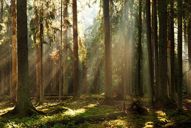
Valgesoo Nature Park

Valgesoo forest, Valgesoo Nature Park, Põlva County, Estonia.
Tolkuse Bog

Tolkuse bog is a wetland in a reserve in south-western Estonia, located halfway between Pärnu and the Latvian border. The bog is located in the Luitemaa national park which consists of the Rannametsa coastline, the Rannametsa dunes (the highest in Estonia) and the Tolkuse wetland.
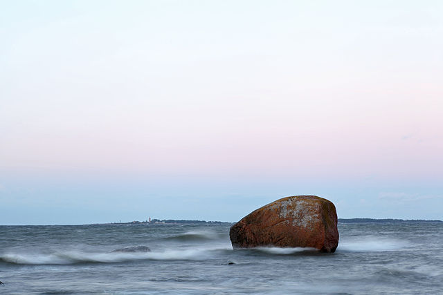
Saarnaki laid

Saarnaki laid is an uninhabited, moraine-based island in the Baltic Sea belonging to the country of Estonia.
Saarnaki laid is a relatively young island; it rose from the Baltic Sea approximately 2,000 years ago. The total area of the island is 140 hectares. The island is 5 kilometres (3 mi) long and 1 km wide. It is 7 to 9 m above sea level. It lies just off the northeastern coast of the island of Hiiumaa, and is administrated by Hiiu County.
Saarnaki laid had previously been inhabited at least since the early 15th Century and was abandoned by the last residents in 1973. It is the largest of the islands that make up the Hiiumaa Islets Landscape Reserve and several former residential and farm buildings on the island have been restored for the benefit of tourists.
Ahja river in Taevaskoda

The Ahja is a river in Estonia. The river is 103.4 kilometres (64.2 mi) long. The river begins at Lake Erastvere and empties into the River Emajõgi.
Lahemaa National Park

Lahemaa National Park is a park located on Northern Estonia, 70 kilometers east from capital Tallinn. The Gulf of Finland is to the North of the Park and the Tallinn-Narva highway (E20) is to the South. Its area covers 725 km² (including 250.9 km² of sea).[1] It was the first area to be designated a national park of the former Soviet Union.

Given its size it is the largest park in Estonia and one of Europe’s biggest national parks. Its charter calls for the preservation, research and promotion of North-Estonian landscapes, ecosystems, biodiversity and national heritage.
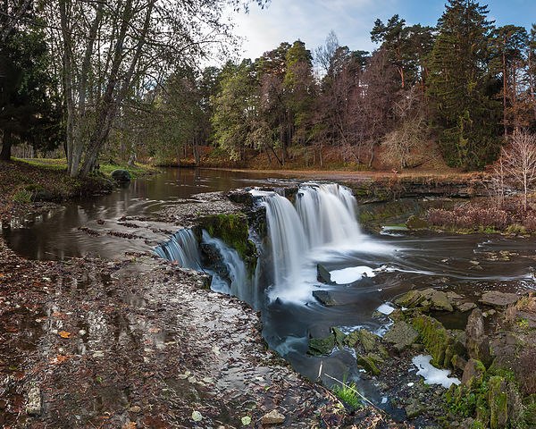
Keila Waterfall

The Keila Waterfall is a waterfall in Northern Estonia on Keila River. It is the third most powerful waterfall in Estonia after Narva and Jägala. It is 6 meters high and 60–70 meters wide.
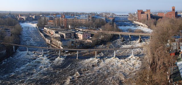
Narva River

The Narva is a river flowing into the Baltic Sea, the largest river in Estonia bydischarge. Draining Lake Peipsi, the river forms the border of Estonia and Russia and flows through the towns of Narva/Ivangorodand Narva-Jõesuu into Narva Bay. Though the river is only 77 kilometres (48 mi) long, in terms of volume discharged it is the second largest river flowing into the Gulf of Finland. The river gives its name to the Narva culture and the city of Narva.
Osmussaar

Osmussaar is an Estonian island situated in the mouth of the Gulf of Finland in the Baltic Sea, 7.5 km off the Estonian mainland. Administratively the island is part of Noarootsi Parish in Lääne County. Its area is 4.8 km2 (1,200 acres).
Before the Soviet Union occupied Estonia during World War II, around 130 people, mainly Estonian Swedes, lived on the island. The continuous settlement of Swedes on Osmussaar had dated back for centuries. Currently Osmussaar has only two permanent inhabitants and the island is a nature reserve.
Põhja-Kõrvemaa Nature Reserve

Põhja-Kõrvemaa Nature Reserve is a protected area in Harju County, NorthernEstonia, some 50 km east of Tallinn. With an area of 130.9 km2, it is the third largest nature reserve in Estonia. Dominated by forests and bogs, it aims to protect rare and endangered species, their habitats, and valuable natural landscapes.
Põhja-Kõrvemaa (meaning North Kõrvemaa) occupies the northern part of Kõrvemaa, which itself forms the northern part of Transitional Estonia, a large forested and sparsely populated area spanning in northeast-southwest direction through Estonia, from Lahemaa through Soomaa to Latvia.
References:
- http://www.7is7.com/otto/estonia/tolkuse.html
- https://en.wikipedia.org/wiki/Saarnaki_laid
- https://en.wikipedia.org/wiki/Ahja_(river)
- https://en.wikipedia.org/wiki/Lahemaa_National_Park
- https://en.wikipedia.org/wiki/Keila-Joa
- https://en.wikipedia.org/wiki/Narva_River
- https://en.wikipedia.org/wiki/Osmussaar
- https://en.wikipedia.org/wiki/P%C3%B5hja-K%C3%B5rvemaa_Nature_Reserve
