Top-10 photos of Morocco

One more national finalists should be announced. Please welcome Morocco’s best photos.

Gazelle

As the sun fades away you get to see a real beauty, you get to see some deer, you can’t actually see any details but their silhouettes glazing within the sun rays| by Anass ERRIHANI – CC-BY-SA-3.0

A gazelle is any of many antelope species in the genus Gazella or formerly considered to belong to it. The name gazelle comes from Arabic name غزال ġazāl. Six species are included in two genera, Eudorcas and Nanger, which were formerly considered subgenera. The genusProcapra has also been considered a subgenus of Gazella, and its members are also referred to as gazelles, though they are not dealt with in this article.

Gazelles are known as swift animals-–some are able to run at bursts as high as 60 mph (97 km/h), or run at a sustained speed of 30 mph (48 km/h). Gazelles are mostly found in the deserts, grasslands, and savannas of Africa; but they are also found in southwest andcentral Asia and the Indian subcontinent. They tend to live in herds and will eat less coarse, easily digestible plants and leaves.

Toubkal

Toubkal/High Atlas Mountains| by Anass ERRIHANI – CC-BY-SA-3.0

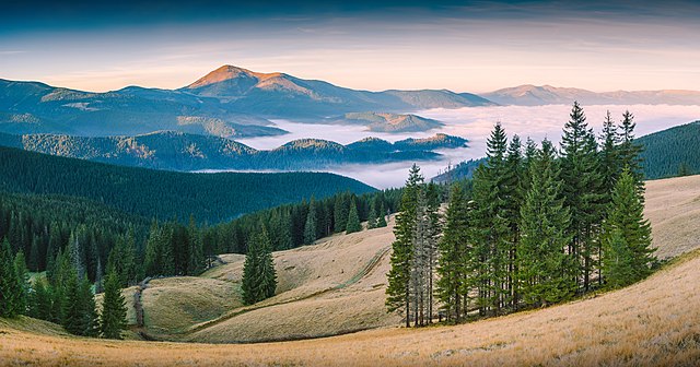
Toubkal or Tubkal is a mountain peak in southwesternMorocco, located in the Toubkal National Park. At 4,167 metres (13,671 ft), it is the highest peak in the Atlas Mountains and inNorth Africa. It is an ultra prominent peak located 63 km south of the city of Marrakesh, and is a popular destination for climbers.

Rif

Rif| by Yascine – CC-BY-SA-3.0

The Rif or Riff is a mainly mountainous region of northern Morocco, with some fertile plains, stretching from Cape Spartel and Tangier in the west to Ras Kebdana and the Melwiyya River in the east, and from the Mediterranean in the north to the river of Wergha in the south. Continue reading “Top-10 photos of Morocco”

Top-10 photos of Bulgaria

Last national finalists should be announced and we are going to know the WLE winner of 2015. Meanwhile take a look at best photos from Bulgaria.

Iskar Gorge

Iskar Gorge in Vrachanski Balkan Natural Park| by Toli Nikolaev – CC-BY-SA-4.0

The Iskar Gorge is a gorge passing through the Balkan Mountains in Bulgaria. It connects Sofia and Mezdra.

The road and railroad follow the course of the Iskar River through a winding, scenic canyon.

he Natural Park “Vrachanski Balkan” is the second largest of the country’s parks, which covers the Vratchanska Mountain and the massif of the Lakatnishki cliff rocks. It has a territory of 28 844 ha most of which is covered with karst limestones, 1 300 meters thick. Unique in their beauty caves and chasms can be seen in the park.

On the territory of the park have been registered about 950 species of high plants, of which more than 80 are rare species. From scientific and preservation point of view the most interesting species are the groups living in the caves (vertebrates and bats) and the day birds of prey. There are 214 registered species of vertebrates in the park.

Little bittern

The little bittern (Ixobrychus minutus) is a wading bird in the heron family Ardeidae| by Biser Todorov – CC-BY-3.0

The little bittern is a wading bird in the heron family Ardeidae, native to the Old World, breeding in Africa, central and southern Europe, western and southern Asia, and Madagascar. Birds from temperate regions in Europe and western Asia aremigratory, wintering in Africa and further south in Asia, while those nesting in the tropics are sedentary. It is rare north of its breeding range.

Banded demoiselle

Female banded demoiselle| by Iliana Teneva – CC-BY-SA-4.0

The banded demoiselle is a species of damselfly belonging to the family Calopterygidae. It is often found along slow-flowing streams and rivers. It is a Eurasian species occurring from the Atlantic coast eastwards to Lake Baikal and northwesternChina. Continue reading “Top-10 photos of Bulgaria”

Top-10 photos of Algeria

We are impressed with Top-10 photos of Algeria. Such strong and clean shots. WLE photographers demonstrated great variety of landscapes and nature. Well done, Algeria!

Ahaggar National Park

Corpse of a donkey in the Ahaggar Cultural Park| by Hamza-sia – CC-BY-SA-3.0

Algeria’s Ahaggar National Park covers an area of approximately 450,000 square kilometers in the Saharan Algeria Region in the extreme south of the country.

https://commons.wikimedia.org/wiki/File:Dune_de_sable_au_parc_Culturel_De_l%27Ahaggar_crop.jpg
Sand Dune at the Cultural Park of Ahaggar, southern Algeria| by Hamza-sia – CC-BY-SA-3.0

The closest populated area near the park, which lies in a desert mountainous zone, is the oasis city of Tamanrasset. The Ahaggar Mountains, also known as the Hoggar, dominate the park, with the highest peak being Mount Tahat, measuring 3,003 meters above sea level.

Papaver

The symbol of parks of Guelma| by Yaco24 – CC-BY-SA-3.0

Papaver is a genus of 70–100 species of frost-tolerant annuals, biennials, and perennials native to temperate and cold regions of Eurasia, Africa and North America. It is the type genus of the poppy family, Papaveraceae.

The flowers have two sepals that fall off as the bud opens, and four (or up to six) petals in red, pink, orange, yellow, or lilac. There are many stamens in several whorls around a compound pistil, which results from the fusion of carpels. The stigmas are visible on top of the capsule, and the number of stigmas corresponds to the number of fused carpels.

Djebel Chélia

landscape in Djebel Chelia| by Hamza-sia – CC-BY-SA-3.0

Djebel Chélia  is a mountain in Algeria. It is the highest point in the Aurès Mountains which straddle the border between Algeria and Tunisia, and it is the second highest peak in Algeria after Mount Tahat. Djebel Chélia is situated in the west of Khenchela, in Bouhmama county. Continue reading “Top-10 photos of Algeria”

Top-10 best photos of France

Top-10 best photos of France most probably are the most diverse list of natural landscapes and life. Enjoy every single shot of it.

Jura Mountains Regional Natural Park

The cascade of Bief de la ruine in April| by Pmau – CC-BY-SA-3.0

Jura Mountains Regional Natural Park is a French regional natural park located in the southwest of the Jura Mountain Range in France, on the French-Swiss border.

The park was created February 10, 1986, and at that time comprised 37 towns. As of 2005, that count is now 113 towns, with a total population of 71,000 inhabitants. The park covers an area of 165,000 hectares across three French departments: Ain, Doubs andJura.

Étang de Vaccarès

Cormorants at dusk on the pond of Vaccarès| by Ddeveze – CC-BY-SA-3.0

Étang de Vaccarès is a lake, or rather; a salt water lagoon (étang), in the wetlands of the Camargue in the delta of the RiverRhône in southern France.

The lake has an area of 65 km², and the depth is less than two meters. It is the northernmost, and also the largest of the lakes of the Camargue, and constitutes the principal element in the water control system of the Rhône delta, which depends upon a strict management of water resources, through pumping, irrigation and draining stations making a complex network of channels throughout the river delta.

Banks of the pond of Scamandre

https://commons.wikimedia.org/wiki/File:Berges_sur_l%27%C3%A9tang_de_Scamandre.jpg
Banks of the pond of Scamandre | by BiacheB – CC-BY-SA-3.0

Salazie

Continue reading “Top-10 best photos of France”

Top-10 Photos of Thailand

How many national parks and resorts one country can have? Looking at Thailand – a lot. This year finalist have shown great variety of natural parks.

Tham Sakoen National Park

Sunrise and morning fog at Phu Langka, Tham Sakoen National Park| by Khunkay – CC-BY-SA-3.0

Tham Sakoen national park is located in Pa Namyoaw and Pa Namsuad forest reserves in Song Kawae district in the northern part of Nan province, close to Laos. The 448 square kilometers park is comprised of north-south rugged mountains that cross the border between Laos and Thailand. The elevation ranges from 300 to 1752 meters above the sea level, the highest peak being Doi Jee at 1752 meters. The mountains are the head waters of Lamnam Yom and Lamnam Nan, two important rivers of the country.

Khun Chae National Park

Sea of clouds at Doi Langka Noi and Doi Langka Luang, Khun Chae National Park| by Patipath – CC-BY-SA-3.0

Khun Chae National Park is a national park in Chiang Rai Province, Thailand. This rugged park is home to high mountains and waterfalls.

Khun Chae National Park is located about 100 kilometres (60  Continue reading “Top-10 Photos of Thailand”

Top-10 Photos Of Ukraine

We getting closer to see winning photos of WLE 2015 and meanwhile you can check top-10 shots from Ukraine.

Carpathian Biosphere Reserve

Carpathian Biosphere Reserve, Zakarpattia Oblast| by Vian – CC-BY-SA-4.0

Carpathian Biosphere Reserve (CBR) was established as a nature reserve in 1968 and became part of the World Network of Biosphere Reserves of UNESCO in 1992. It consists of six separate massifs, two botanic preserves (Chorna Hora and Yulivska Hora) and regional landscape park Stuzhytsia, with a total area of 57,880 hectares (143,000 acres). The greatest part of the reserve is covered by virgin forests.

Carpathian Biosphere Reserve, Zakarpattia Oblast| by Vian – CC-BY-SA-4.0

Administratively, the biosphere reserve is located in four districts of Zakarpattia Oblast, Ukraine. It is adjacent to the Carpathian National Nature Park.

Carpathian Biosphere Reserve, Zakarpattia Oblast| by Vian – CC-BY-SA-4.0

Kinburn Foreland

Continue reading “Top-10 Photos Of Ukraine”

Top-9 Photos of Portugal

One more list of best photos came from Portugal this time. National winners were inspired with forests and mountains. Surprisingly but you will not find a lot of photos of the ocean. Enjoy!

Laurel forest

View of the Laurisilva (Laurel Forest), island of Madeira| by Jnvalves – CC-BY-SA-3.0

Laurel forest, also called laurisilva or laurissilva, is a type of subtropical forest found in areas with high humidity and relatively stable, mild temperatures.

Fanal protected area| by Jnvalves – CC-BY-SA-3.0

The forest is characterized by broadleaf tree species with evergreen, glossy and elongated leaves, known as “laurophyll” or “lauroid”. Plants from the laurel family (Lauraceae) may or may not be present, depending on the location.

Old roads and passagens between villages and other places in Madeira Islan surronded by UNESCO protected prehistoric forest| by Luismiguelrodrigues – CC-BY-SA-3.0

Serra da Estrela

Morning fog in the Serra da Estrela| by Sara Bento Photography – CC-BY-SA-4.0

Continue reading “Top-9 Photos of Portugal”

Top-10 best photos of Nepal

National winners of WLE Nepal showing us stunning mountain landscapes and a lot of space on their photos.

Tetang

Tetang terraced fields| by Jmhullot – CC-BY-SA-3.0

Langtang National Park

Langtang National Park| by Q-lieb-in – CC-BY-SA-4.0

The Langtang National Park is the fourth national park in Nepal and was established in 1976 as the first Himalayan national park. The protected area exceeds an altitudinal range of 6,450 m (21,160 ft) and covers an area of 1,710 km2 (660 sq mi) in theNuwakot, Rasuwa and Sindhulpalchok districts of the central Himalayan region encompassing 26 Village Development Committees. It is linked with the Qomolangma National Nature Preserve in Tibet. The high altitude sacred lake of Gosainkundafalls within the park. The Gosainkunda lake (4,300 m (14,100 ft)) and the Dorje Lakpa range (6,988 m (22,927 ft)) bisect the park from east–west to south–east. The summit of Langtang Lirung (7,245 m (23,770 ft)) is the highest point in the park.

View from mountain pass Laurebina-la| by Q-lieb-in – CC-BY-SA-4.0

The northern and eastern border of the national park coincide with the international border to Tibet. The western boundary follows the rivers Bhote Kosi and Trisuli. The southern border lies 32 km (20 mi) north of the Kathmandu Valley. Continue reading “Top-10 best photos of Nepal”

WLE-2015 active users – Spas from Bulgaria

Bulgarian national team continues to acquaint us with their most active users.

We asked Spas to shortly present himself in a couple of sentences, and here is what he said:

I am interested in geography and history, love travelling and taking pictures. I’ve been editing Wikipedia since the beginning of 2008, and for the last two or three years I’ve been working on the digitalization of documents and images from Bulgarian Archives State Agency, with which Wikimedians of Bulgaria work together.

Vihren, Pirin National Park| by Спасимир – CC-BY-SA-4.0

Spas, you took part in the competition with more than 250 pictures of Bulgarian nature sites. It seems you have travelled across the whole country with a backpack. Tell us more about that. Have you visited all those places with the purpose to take pictures for Wikipedia?

It seems like that, but it is not quite so. One life would not be enough to visit all those places in Bulgaria, and the world is so much bigger. During the recent years, I have combined the pleasure of travelling, experiencing and photographing. I always travel with a digital camera, but I do not think of myself as a photographer. I find it good to save what has been seen in this way. Yet, to hold these pictures only for myself is pretty egoistic. Therefore, I upload them to a safe and useful place like Wikipedia, and more exactly in the multimedia repository – Wikimedia Commons. This is the images, which are of encyclopaedic value, and which could be used for illustrating articles, of course.

You have been contributing to Wikipedia and have donated thousands of your images to Wikipedia before the contests. Why is this important for you? What motivates you to share your works under a free licence? Continue reading “WLE-2015 active users – Spas from Bulgaria”

Top-10 best photos of Brazil

Do you like some fantastic landscapes that look unreal? We enjoy them a lot. Brazilian team presented their Top-10 creative photos. Such a strong and clean shots will impress you a lot.

Sertão

Sertão| by Ruy Carvalho – CC-BY-SA-3.0

The Sertão is one of the four sub-regions of the northeast of Brazil. Originally the term referred to the vast hinterlands of Asia and South America that Lusitanian explorers encountered. In Brazil it referred to backlands away from the Atlantic coastal regions where the Portuguese first settled in South America in the early sixteenth century. A Brazilian historian once referred to colonial life in Brazil as a “civilization of crabs”, as most settlers clung to the shoreline, with few trying to make inroads into the sertão. In modern terms, “sertão” refers to the semi-arid region inNortheastern Brazil comprising parts of the states of Alagoas, Bahia, Pernambuco, Paraíba, Rio Grande do Norte, Ceará,Maranhão, Piauí, and parts of northern Minas Gerais. The term Vaqueiro is similar to the generic use of “cowboy” in the United States.

Niterói City Park

All of those beautiful mountains of Rio de Janeiro, seen from Parque da Cidade in Niterói during warm sunset| by dabldy – CC-BY-SA-3.0

The City Park in Niteroi is Located in an area of ​​environmental protection The place Reserve one of the best views of Rio de Janeiro and Niteroi. From the top of the hill you can see the beaches of Niteroi (Camboinhas, Itaipu, Icarai and Jurujuba) and a spectacular view of Rio de Janeiro. If you want a little more emotion, on the Park you can jump from a gliding.

Abismo Anhumas

Abismo Anhumas| by Caio Vilela – CC-BY-SA-3.0

A cave in Bonito, Mato Grosso do Sul. This cave is equipped with a scuba diving platform and sunlight reaches down to the bottom during certain parts of the day.

Araucaria Forest

Araucaria Forest| by Gui Becker – CC-BY-SA-3.0

The Araucaria moist forests are a coniferous forest ecoregion of the Atlantic Forest Biome. The forest ecosystem is located in southern Brazil and northeastern Argentina. Continue reading “Top-10 best photos of Brazil”