
We getting closer to see winning photos of WLE 2015 and meanwhile you can check top-10 shots from Ukraine.
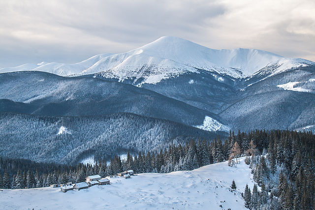
Carpathian Biosphere Reserve
Carpathian Biosphere Reserve (CBR) was established as a nature reserve in 1968 and became part of the World Network of Biosphere Reserves of UNESCO in 1992. It consists of six separate massifs, two botanic preserves (Chorna Hora and Yulivska Hora) and regional landscape park Stuzhytsia, with a total area of 57,880 hectares (143,000 acres). The greatest part of the reserve is covered by virgin forests.

Administratively, the biosphere reserve is located in four districts of Zakarpattia Oblast, Ukraine. It is adjacent to the Carpathian National Nature Park.

Kinburn Foreland

Kínburn Foreland or Kinburn Spit – a spit in Ochakiv Raion (district) of Mykolaiv Oblast at the Black Sea in Ukraine. It occupies the western part of the Kinburn peninsula, being its natural extension stretching west into the Black Sea between the Dnieper-Buh estuary and the Bay of Yahorlyk. Its length is about 40 km, width – 8–10 km. In southern Ukraine, the Kinburn Foreland is often mistaken for being the entirety of the Kinburn Peninsula, of which it appears to be a part.
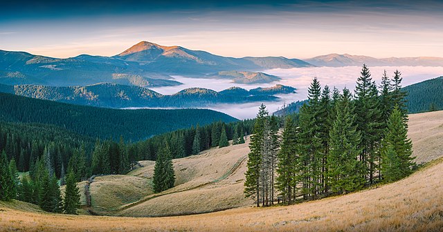
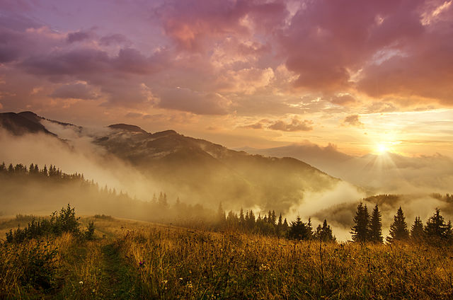
Carpathian National Nature Park
The Carpathian National Nature Park is a National Park located inIvano-Frankivsk Oblast, Ukraine. The park was established on 3 June 1980 to protect landscapes of the Carpathian Mountains. The headquarters of the park are in Yaremche. Carpathian National Nature Park is the first national park of Ukraine and one of the biggest national parks of this country.
The area of the park is shared between Nadvirna Raion and Verkhovyna Raion in the southwest of Ivano-Frankivsk Oblast, at the border with Zakarpattia Oblast. The area of the park is 515.7 square kilometres (199.1 sq mi), of which 3,834 square kilometres (1,480 sq mi) is the area where any economic activity is prohibited.[1] The park is located in the highest part of the Ukrainian Carpathians, on the eastern slopes in the drainage basins of the Prut River and the Black Cheremosh River. The Prut has its source in the park, and the highest point of Ukraine, Mount Hoverla (2,061 metres (6,762 ft)), is located at the borders of the park. The lowest point of the park is about 500 metres (1,600 ft).
Demerdji

Khaphal Reserve

Southern Bug

The Southern Buh, also called Southern Bug is a river located in Ukraine.

The source of the river is in the west of Ukraine, in the Volyn-Podillia Upland, about 145 km from the Polish border, from where it flows southeasterly into the Bug Estuary (Black Sea basin) through the southern steppes. It is 806 kilometres (501 mi) long and drains 63,700 km².
Major cities on the Southern Bug: Khmelnytskyi, Vinnytsia, Pervomaisk, Mykolaiv.
References:
- https://en.wikipedia.org/wiki/Carpathian_Biosphere_Reserve
- https://en.wikipedia.org/wiki/Kinburn_Foreland
- https://en.wikipedia.org/wiki/Carpathian_National_Nature_Park
- https://en.wikipedia.org/wiki/Southern_Bug