
By the Swedish Wiki Loves Earth Team
Wiki Loves Earth photo contest is on! One of the teams that have their local competitions in May is WLE in Sweden. This year they have implemented an innovative digital instrument for their lists of nature monuments — an interactive map.
This user-friendly visualization of lists makes it easy and convenient to find an area and upload photos. It not only helps to reduce barriers in participating in WLE, but also can be improved/customized further and play an important role for the global community. We asked the team why and how they have developed this tool.
— What is the idea behind this map, and what are its main features?
Wiki Loves Earth’s goal is to document and highlight the beauty of nature of our planet. But WLE also can be used strategically. Millions of people use Wikimedia projects daily, but very few of them decide to contribute. They may conceive of it as time-consuming, difficult or challenging. And Wiki Loves Earth helps to involve new contributors and drastically lower barriers for editing Wikipedia, which is also an important goal of this global contest.
Bearing this in mind, we spent some time considering how we can contribute to lower these barriers even further. What aspects make it hard for people to contribute today, even if they would like? How can we make it easy for anyone who sees the WLE banner on top of Wikipedia to upload their photos?
The problem we tackle is navigation around lists of objects. Participants have to go through many layers of lists on Wikipedia, using information from different platforms. They need to know how to navigate around pages on Wikipedia and Wikimedia Commons and how to find out where objects are situated. Many Swedish municipalities are very large, so only saying that an object is based in a municipality doesn’t say much for someone who doesn’t know the area very well.
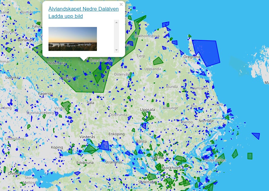
The way of solving the complexity of both lists and coordinates is to develop a map. Using shapefiles of all national parks, natural reserves, biosphere reserves and natural monuments from the Environmental Protection Agency of Sweden, we created a map of these objects. Its features are:
- it helps to see all the objects;
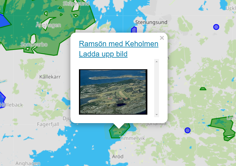
- objects have different colours: green already have photos and blue objects are lacking them;
- it includes a direct link to the upload campaign, so people can upload a photo directly from the map.
It brings us closer to lowering the barriers for contributing photos.

— What was the development process of this map?
It has been developed using the Minimal Viable Product-design pattern in three iterations searching for features and our priorities.
From the technical side, we used a Java backend. Every few minutes it polls Wikidata for updated entities since the previous poll with an identity claim for the Swedish Environmental Protection Agency (Natuvårdsverket ID, P3613). This allows to download all relevant entries from Wikidata and keep the local data store semi-synchronized with Wikidata as new images are uploaded. One more feature is when zooming out and having multiple points on the map (e.g. 100 specific trees in a confined space) we transform the result to a simplified view. It helps to avoid overloading the client with a large number of complex polygons. This step is crucial for mobile view.
The map is an OpenStreetMap layer on which we draw polygons and markers.
— How can it be used in other wikiprojects?
We believe that geodata has great potential for the Wikimedia platforms, and this project is a way of experimenting with that. The map so far is tuned according to the needs of Wikimedia Sverige, and it is not possible to apply it on other WLE local contests. But there are potential ways of internationalizing it:
- Using it by different communities according to their needs (data storage, etc.). We can provide documentation on what is needed, but it’s important to have someone experienced enough with coding.
- Making it generic and configurable across language versions.
- Rebuilding it adding strategies of each country to produce a single global map.
We aim to collect feedback and input on the map’s functionality during WLE. But also we need help from the international community:
- Is there interest from the international community in this kind of maps?
- What would the international community like to see in this kind of map in that case? What works and what doesn’t work?
- If it works, and if the international community wants a map of similar sorts, where should it be hosted? Where should we provide documentation?
