Wiki Loves Earth 2015 has ended in the most of the countries. And now it’s time to evaluate the photos and select the best of them for international part of the competition. We got first results and Top-10 photos from Pakistan.
As you probably remember we wrote that Pakistanis users were extremely active and uploaded over 11 000 photos. That made Pakistan the absolute leader in the country race till the last week before the end of the contest. Nevertheless organizers managed to choose Top-10 photos of Pakistan in the first couple of days after the end of WLE 2015.
«WLE 2015 took place in Pakistan from 1 till 31 May. We have got over 11 000 uploaded photos. We promoted the contest with social media and central notice banner. The local BBC burro made a story about Wikipedia Loves Northern Pakistan and that’s also gave us extra coverage and good number of participants. Our national part of the contest was focused only on northern areas of Pakistan. That’s the reason why we named it Wikipedia Loves Northern Pakistan. We believe that the northern part of the country is the most beautiful and attractive for the photo competition.
We decided to launch ongoing selecting prosess from the 1st day of the contest. So we asked our jury from the last year competition (Yaroslov from Russia, Daniele from Germany and Marc from Belgium) to judge these year pictures. National team shortlisted 150 photos and gave them to jury. So that’s how we choose national winners that fast», – commented the results of the contest SAQIB QAYYUM, national organizer of WLE Pakistan.
The international winners of Wiki Loves Earth 2015 are yet to be announced, but the Top-10 photos of Pakistan are here:
Hunza Valley
The Hunza is a mountainous valley in the Gilgit–Baltistan region of Pakistan. The Hunza is situated north/west of the Hunza River, at an elevation of around 2,500 metres (8,200 ft). The territory of Hunza is about 7,900 square kilometres (3,100 sq mi).

Baltoro Glacier
The Baltoro Glacier, at 63 km (39 mi) in length, is one of the longest glaciers outside the polar regions. It is located in Baltistan, in the Gilgit-Baltistan region of Pakistan, and runs through part of the Karakoram mountain range. The Baltoro Muztagh lies to the north and east of the glacier, while the Masherbrum Mountains lie to the south. At 8,611 m (28,251 ft), K2 is the highest mountain in the region, and three others within 20 km top 8,000 m.

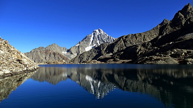
Dudipatsar Lake
Dudipatsar Lake or Dudipat Lake is a lake encircled by snow clad peaks in Lulusar-Dudipatsar National Park. The lake lies in the extreme north of the Kaghan Valley, in the Mansehra District, Khyber Pakhtunkhwa province, in northern Pakistan. The word “dudi” means white, “pat” means mountains and “sar” means lake. This name has been given to the lake because of the white color of snow at surrounding peaks. In summer the water of the lake reflects like a mirror.

Jabba Zomalu Lake
Jabba Zomalu Lake,Elevation 14040 ft approx. Ushu Valley Kalam-Swat-Pakistan. It gives unique view of Mt. Falaksar (Elev.19416 ft), this lake is very rarely visited and never been photographed earlier.

Nanga Parbat
Nanga Parbat is the ninth highest mountain in the world at 8,126 metres (26,660 ft) above sea level. It is the western anchor of the Himalayas around which the Indus river skirts into the plains of Pakistan. It is located in the Gilgit-Baltistan region of Pakistan.

An immense, dramatic peak rising far above its surrounding terrain, Nanga Parbat is also a notoriously difficult climb. Numerous mountaineering deaths in the mid and early 20th century lent it the nickname “killer mountain”. Along with K2, it has never been climbed in winter.

The Rakaposhi Peak
Rakaposhi, is a mountain in the Karakoram mountain range in Pakistan. It is situated in the Nagar Valley approximately 100 km north of the city of Gilgit in the Gilgit District of the Gilgit–Baltistan province of Pakistan. Rakaposhi means “Snow Covered” in the local language. Rakaposhi is also known as Dumani (“Mother of Mist”). It is ranked 27th highest in the world and 12th highest in Pakistan, but it is more popular for its beauty than its rank might suggest. In a colloquial sense, i.e. measured from base to summit, Rakaposhi with its uninterrupted ~6000 m vertical rise, is the tallest mountain on Earth.

Shangrila Resorts
Shangrila Lake or Lower Kachura Lake is a part of the Shangrila resort located at a drive of about 20 minutes from Skardu town.
It is a popular tourist destination, and has a unique restaurant that is built on the fuselage of an aircraft that had crashed nearby.
The Kachura Lakes are two lakes in the Skardu District of Gilgit-Baltistan, northern Pakistan. The lakes, at 2,500 metres (8,200 ft) in elevation, are Upper Kachura Lake and Lower Kachura Lake.
The lakes are in the Karakoram mountain range of the western Himalayas, the greater Kashmir region, and in the Indus River basin.

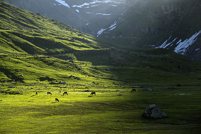
Shgraan Valley
Shogran is a village situated on a green plateau in the Kaghan Valley, northern Pakistan at a height of 7,749 feet or 2,362 metres above sea level.
Shogran is located at a distance of 34 km away from Balakot. The road from Islamabad to Kiwai is metalled and measures 212 km. From Shogran, you can ride a jeep or horse or hike to several picturesque places like Siri, Paye and Makra Peak.

Shounter Valley

References:
- Hunza Valley – http://en.wikipedia.org/wiki/Hunza_Valley
- Baltoro Glacier – http://en.wikipedia.org/wiki/Baltoro_Glacier
- Dudipatsar – http://en.wikipedia.org/wiki/Dudipatsar
- Nanga Parbat – https://en.wikipedia.org/wiki/Nanga_Parbat
- Rakaposhi – http://en.wikipedia.org/wiki/Rakaposhi
- Shangrila Lake – http://en.wikipedia.org/wiki/Shangrila_Lake
- Kachura Lake – http://en.wikipedia.org/wiki/Kachura_Lake
- Shogran – http://en.wikipedia.org/wiki/Shogran

Amazing, Mesmerizing, Superb