
Photographers from Andorra and Catalan speaking areas demonstrated patience and personal artistic vision on nature. Check out Top-10 best photos from Andorra and Catalan areas.
Sant Miquel del Fai

Sant Miquel del Fai is a cenobitic Benedictine monastery in Bigues i Riells, Catalonia, Spain. The 11th-century building was declared a Bien de Interés Cultural landmark in 1988.
The monastery is located in a well-preserved natural environment framed by rocky cliffs called Cingles Bertí in the Catalan pre-coastal mountain range which geographically separates the region of Vallès Oriental in the subregion of Moianés. The Natural Area Sant Miquel del Fai is located in the town of Bigas.
Ports de Tortosa-Beseit

Ports de Tortosa-Beseit, also known as Ports de Beseit, or simply as ElsPorts or Lo Port by locals, is a limestone mountain massif located at the north-eastern end of the Sistema Ibérico, a complex system of mountain ranges and massifs in the centre of the Iberian Peninsula. Its highest point isMont Caro, 1,441 m. Rivers such as the Matarranya and the Sénia have their source in these mountains.
Cadí-Moixeró Natural Park

The Cadí-Moixeró Natural Park is a natural park to the north of Catalonia, Spain, near the border with Andorra. The park was established in 1983 and encompasses 41,060 hectares (101,500 acres) of mountainous terrain in the comarques of Alt Urgell, Berguedà and Cerdanya. It stretches for more than 30 kilometers over themountain ranges of Serra del Cadí and Serra de Moixeró, with Vulturó standing at 2,648 metres (8,688 ft) as its highest point.
Valls del Comapedrosa Nature Park

The Valls del Comapedrosa Nature Park is in the north-west of the Principality of Andorra, in the parish of La Massana.
Its territory includes the Pic del Comapedrosa, Andorra’s highest peak (2,942m), which gives the park its name.
The Valls del Comapedrosa Nature Park covers a protected area of 15.42 km2. It stands out for its imposing high mountain scenery formed by forests, lakes and waterfalls. Its network of hiking routes and high mountain huts allows for a large number of excursions to contemplate the local fauna and flora.
Collsacabra

Collsacabra area is one of Europe’s leading natural areas. Cliffs, forests of beeches, oaks, meadows are a must for any nature lover. Wildlife, vegetation and medieval origin of the village make Rupit one of the most interesting landscapes of Europe.
Collsacabra is raised on an extensive plateau on top of cliffs hundreds of meters high where an interesting animal diversity of mammals, birds and amphibians lives in. From Rupit can easily be seen vultures, eagles, newts and salamanders, honey eater, deer or badgers.
The Noguera Ribagorçana

The Noguera Ribagorçana or Noguera Ribagorzana is a river in northern Spain. For much of its course of 130 km it forms the administrative boundary between Catalonia and Aragon. Its source is in the municipality of Vielha e Mijaran (Aran Valley) at an elevation of about 2400 m, and its upper valley forms the main access route to the Aran Valley (N-230 road and the Vielha tunnel (5230 m long) under the watershed). It passes through the traditional county of Ribagorça and the town of Pont de Suert (Alta Ribagorça). Dams form two large reservoirs, the Escales below Pont de Suert and the Canelles above Ivars de Noguera (Noguera). The Noguera Ribagorçana joins the Segre from the right at Vilanova de la Barca (Segrià). It drains a basin of 2036 km².
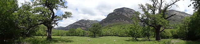
Roures d’Hortmoier
Cap de Formentor

Cap de Formentor forms the eastern end of Majorca’s Formentor peninsula. The Majorcans also call the cape the Meeting point of the winds.
Cap de Formentor is a spectacular place, located on the northernmost point of the Balaeric Island Majorca in Spain. Its highest point,Fumart, is 384m above sea level. It has many associated bays, including Cala Fiquera, Cala Murta and Cala Pi de la Posada.
The 13.5 km road which runs from Port de Pollença to Cap de Formentor was built by the Italian engineer Antonio Parietti. His masterpiece on Majorca, however, was the snake to Sa Calobra. Instead of being overwhelmed by what stood in his way on the cliffs, Parretti observed the Tramuntana winds and understood: where the slope was too steep, he made a curve. When he had to remove part of the cliffs, he placed the waste in other places where it was needed. The result was the two roads, which are nestled together in the mountains like abandoned silk ribbons.
Estany de les Truites

Prades Mountains

rades Mountains, also known as Muntanyes de Prades, is a large calcareousmountain massif straddling the comarcas of Alt Camp, Baix Camp, Conca de Barberà,Garrigues and Priorat, in Catalonia, Spain. These mountains have characteristic large and rounded rocky outcrops. They are mostly heavily forested with oak and pine trees, and the non-native chestnut tree has adapted to the local forests.
The range runs in an east to west direction and is part of the Catalan Pre-Coastal Range. The main peak is Tossal de la Baltasana (1203 m), other summits are Mola d’Estat (1127 m), Mola dels Quatre Termes (1117 m), La Mussara (1055 m), and Punta de la Barrina(1013 m). The 731 m high Tossal de la Creu is a visible landmark from the Poblet Monastery, located at the feet of the range.
The Francolí River has its source in these mountains as well as other minor local rivers.
References:
- https://en.wikipedia.org/wiki/Sant_Miquel_del_Fai
- https://en.wikipedia.org/wiki/Ports_de_Tortosa-Beseit
- https://en.wikipedia.org/wiki/Cad%C3%AD-Moixer%C3%B3_Natural_Park
- http://visitandorra.com/en/summer/itineraries/valls-del-comapedrosa-nature-park/
- http://www.rupitviu.com/en/rupit-collsacabra/
- https://en.wikipedia.org/wiki/Noguera_Ribagor%C3%A7ana
- https://en.wikipedia.org/wiki/Cap_de_Formentor
- https://en.wikipedia.org/wiki/Prades_Mountains