Top-10 best photos of Estonia

What do you know about Estonia? Did you ever consider it as a land of seas and forests? Well, you will. Just take a look at top-10 best photos of Estonia. We are impressed with the variety of landscapes.

Valgesoo Nature Park
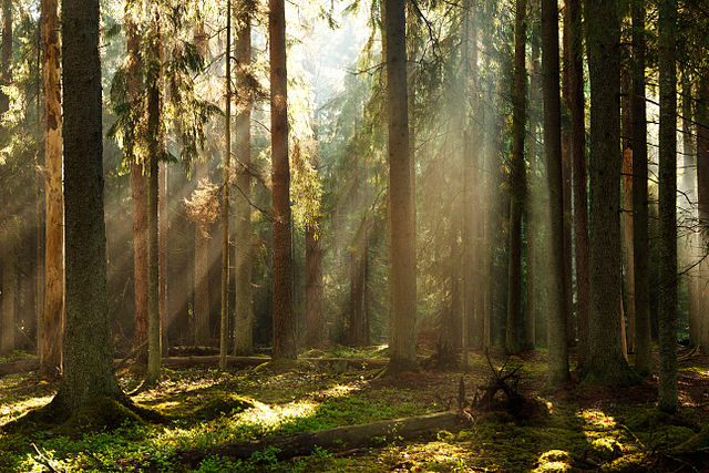
Valgesoo forest, Valgesoo Nature Park| by Külli Kolina – CC-BY-SA-3.0-EE

Valgesoo forest, Valgesoo Nature Park, Põlva County, Estonia.

Tolkuse Bog

Morning in Tolkuse bog, Luitemaa Nature Conservation Area| by Märt Kose – CC-BY-SA-3.0-EE

Tolkuse bog is a wetland in a reserve in south-western Estonia, located halfway between Pärnu and the Latvian border. The bog is located in the Luitemaa national park which consists of the Rannametsa coastline, the Rannametsa dunes (the highest in Estonia) and the Tolkuse wetland.

Saarnaki laid

Old small-leaved lime (Tilia cordata) in Saarnaki islet| by Kairi Kalmann – CC-BY-SA-3.0-EE

Saarnaki laid is an uninhabited, moraine-based island in the Baltic Sea belonging to the country of Estonia.  Continue reading “Top-10 best photos of Estonia”

TOP-10 best photos of Russia

Wiki Loves Earth Russia presents us their top-10 best photos. This year there are a lot of photos of different water objects among them. Russian national winners presenting clean and simple vision of nature. Enjoy these powerful shots.

Franz Josef Land

Iceberg at Franz-Josef Land Reserve| by Николай Гернет – CC-BY-SA-4.0

Franz Josef Land, Franz Joseph Land or Francis Joseph’s Land is an uninhabited archipelago located in the Arctic Ocean, Barents Sea and Kara Sea, constituting the northernmost part ofArkhangelsk Oblast in Russia. It consists of 191 islands, which cover an area of 16,134 square kilometers (6,229 sq mi), stretching 375 kilometers (233 mi) from east to west and 234 kilometers (145 mi) from north to south.

The islands are categorized in three groups, a western, central and eastern, separated by the British Channel and the Austrian Strait. The central group is further divided into a northern and southern section by the Markham Strait. The largest island is George Land, which measures 2,741 square kilometers (1,058 sq mi), followed by Wilczek Land, Graham Bell Island and Alexandra Land.

Kungur Ice Cave

Kungur Ice Cave| by Владимир Чуприков / reworked by A.Savin – CC-BY-SA-4.0

Kungur Ice Cave is a karst cave located in the Urals, near the town Kungur in Perm Krai, Russia, on the right bank of theSylva River. The cave is famous for its ice formations and is a popular tourist landmark. Continue reading “TOP-10 best photos of Russia”

National part of the contest is officially closed

We are glad to inform that national part of the WLE 2015 has ended on 1 July. International team of Wiki Loves Earth wants to thank to all national organizers of the contest and to active participants and photographers. You rocked it.

Shgraan Valley – Pakistan| by DanialYaqub – CC-BY-SA-3.0

This year contest was international with 26 countries participating from four different continents – Europe, Asia, Africa and America. Most of countries organised the contest from 1 May to 31 May 2015, while some countries extended the contest period till 30 June. Continue reading “National part of the contest is officially closed”