Protected areas in Bulgaria – a story by a participant at Wiki Loves Earth 2015

Today we present you an intimate story by one of the participants at the first edition of Wiki Loves Earth in Bulgaria in 2015 – Spasimir Pilev – who visited a number of protected areas in order to donate pictures of them to Wikimedia.

Thanks to its geographical position, Bulgaria has exceptionally rich and beautiful nature. Most interesting for me are the still well conserved ecosystems in the bordering mountains – Strandzha (bordering Turkey), Slavyanka (called also “Ali Botush”, bordering Greece), Belasica (bordering Greece and Republic Macedonia), Osogovo (bordering Republic Macedonia) and Ruy (bordering Serbia). While Bulgaria was part of the Eastern Bloc, these mountains fell in the 30-kilometre-wide border zone which required a special permission to get in. This is one of the reasons why nature has remained almost untouched by humans for decades.

During last year’s Wiki Loves Earth photo contest, in June, I decided to visit some protected nature reserves and areas in the inner parts of the country. My most visited destinations were the Sredna Gora and the West Rhodope Mountains.

“Eledzhik” protected area

My first trip was to the Eledzhik protected area, which is situated in the Ihtiman part of Sredna Gora and has an area of 668 ha. It contains protected fagus sylvatica forests. A starting point for the journey is the abandoned train station Nemirovo, named after the Bulgarian writer from the beginning of the 20th century Dobri Nemirov. The beginning of June is a wonderful time for taking pictures – the forest is green already, and many of the bushes are still in blossom. Wild strawberries have started to ripen. A few times I heard running hares near the river.

St. Marina protected area

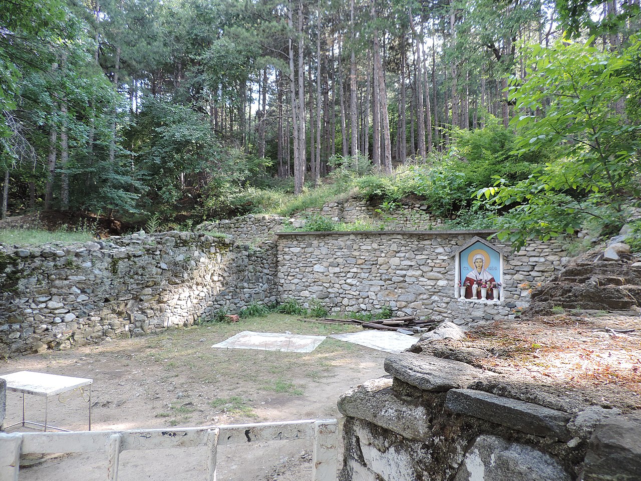
During the following two or three weeks, I travelled to four less known protected areas, aiming to take pictures which would be suitable for illustrating Wikipedia articles. These areas are situated in the Western Rhodope Mountains. Some of them, as many other protected areas in Bulgaria, were historical sites in the past. In most of the cases, they are related to the Bulgarian resistance movement during World War II. Often the names of the protected areas in Bulgaria are very interesting. In the Western Rhodope Mountains I reached “Koritata” (The Trays) and “Ezeroto” (The Lake) where the object of preservation is their characteristic landscape; “Sveti Georgi”, which was created for protecting a natural field of summer snowflake (Leucojum aestivum) and “Marina” in which there are protected centuries-old sessile oaks. At the beginning it was declared a nature site, but later it was re-categorised as a protected area. Interesting are the still preserved foundations of a church from the Early Middle Ages, dedicated to St. Marina. Again thanks to the contest “Wiki Loves Earth”, I learned that these protected areas are part of a larger territory from a protected zone named “Yadenica” of the ecological network of the European Union Natura 2000 according to the Council Directive 92/43/EEC of 21 May 1992 on the conservation of natural habitats and of wild fauna and flora.

In some parts of the declared protected areas, endemic and relict species are preserved.

For my birthday, several days after the end of the competition, I made myself the present of climbing the highest peak of the tenth highest mountain in Bulgaria – the Big Bogdan peak in the Sredna Gora mountain. It belongs to the Bogdan reserve where oak forests of average age of 150 years are preserved.

For the rest of the days I had the good motivation to upload pictures from previous years to Wikimedia Commons – from the protected areas in Pirin, Balkan Mountains, Belasica, Rhodope Mountains. Many of them were used for illustrating numerous articles.

All of those protected areas – national parks, nature parks, reserves, protected areas, nature sights, protected “Natura 2000” zones – are of crucial importance for the preservation of nature and us, humans. Travelling with motor vehicles, hunting, and cutting down trees are forbidden, and walking is only permitted along the marked paths. This is important for Wikipedia, too, because the more is known about the importance of these unique areas, the bigger is the possibility to get a clear notion that they are of great importance for humans’ life, too, and thus help for their preservation.

“Uvac” Special Nature Reserve

“Uvac” Special Nature Reserve

“Uvac” Special Nature Reserve is a protected natural asset of great importance, situated in south-western Serbia in the region of Stari Vlah – Raška high plateau, set between Mt. Javor in the Northeast and Mt. Zlatar massif in the Southwest. It has been protected since 1971 and occupies the territory of 7543 ha in total. The minimum altitude in the reserve is 760 m above sea level, and the maximum – 1322 m.

Major morphological feature of the reserve is the Uvac River canyon valley which includes the valleys of its tributaries. The special value of canyon parts of the river valley are curving meanders. The relative height of meander heads is 100 m at places.

The surrounding is characterised by karst surface with numerous karst formations: plains, depressions, sinkholes, rock shelters, caves and potholes. Caves are numerous and vary in size, including Usak Cave System, the largest known cave system in Serbia (6185 m). Caves are very rich in speleothem deposited by the action of dripping water to form stalactites, stalagmites, columns, draperies etc.

Hanging bridge in “Uvac” Nature Reserve, second placed in Wiki Loves Earth 2015 in Serbia

“Uvac” Special Nature Reserve is distinguished by the presence of 104 bird species. Most important of all is the griffon vulture, one of the two vulture species that are still nesting in Serbia.

Variety of intact habitats, presence of endemic, rare and endangered flora and fauna species have special importance in terms of preservation of biodiversity and geodiversity and, by itself in terms of development and promotion of tourism potential of the reserve.

Sources

Wiki Loves Earth 2016 captures the nature!

On May 1, 2016 the Wikimedia community is starting an international photo contest with a natural heritage theme, Wiki Loves Earth 2016. Wiki Loves Earth is organized through numerous national contests, coordinated by local volunteers.

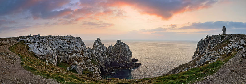
Panorama stitching of the pointe de Pen-Hir. Finalist of Wiki Loves Earth 2015 in France. Photo by Diwall, freely licenced under CC-BY-SA-3.0

This is the fourth year of the competition. In 2015 there were 19 countries in the contest and this year it encompasses Algeria, Australia, Austria, Azerbaijan, Brazil, Bulgaria, France, Germany, Moldova, Nepal, Pakistan, Russia, Serbia, Spain, Tunisia and Ukraine — Wikimedians from these countries are willing to help sharing their natural monuments with the world!

Wiki Loves Earth belongs to the widest photo competitions, we are really happy that you like it. WLE becomes a movement, there are people who donate there time and photos into it year by year. Devoted participants — and also newcomers! — help decrease blind spots on map and highlight unknown places and sights in their countries.

This photo contest is not only a great opportunity to show the charms of nature, but also a chance to draw public attention to environmental problems. Together we can create word wide heritage base of natural objects. Together we will raise awareness about natural resources and zones and their protection.

Anyone can take part in the competition; however, registration on Wikimedia Commons is required. To enter the contest, find an item or place you are familiar with from the competition list, submit a picture you have taken (past or present), and upload it to Wikimedia Commons beginning May 1 through May 31, 2016.

If you would like to join international WLE with your local contest or have any other questions, please, write on wle-team@wikimedia.org.ua

Steinerne Rinnen – karst phenomena in Germany

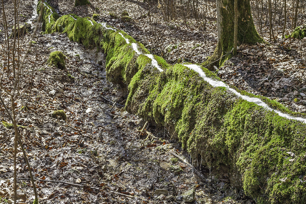
Calcareous tufa gutter by Derzno, CC-BY-SA-3.0

Steinerne Rinnen” or calcareous tufa gutters are rare karst phenomena. The main occurrence of such kind of gutters is in the hilly areas of Franconia, in the northern part of Bavaria in Germany. It would be interesting to know if such geologic gutters can be found elsewhere as well as the local names for such formations. The formation of such karsts require a fountain rich with dissolved carbonate, a terrain steep enough for a fast-running stream, and some mosses or algae in or near the water. In this case, sedimented tufa slowly forms a certain kind of a wall-like structure with the water-stream on top of it. The longest gutter in Germany is approximately 150 m long. The tallest known gutter reaches a height of 5.4 m. The natural protection state of a “Steinerne Rinnen” can be different. Sometimes they are protected as a natural monument or registered by a so called geotope. Others are simply part of a larger protected area.